Location

Home Labs Location Publications


Office: Burchard-426


Labs: Burchard-311, Burchard-415


Campus map       Interactive campus map.

The Burchard building is labeled as number 4 on the campus map.

The Burchard building is at the intersection of 6th Street and River Street in Hoboken, NJ 07030

GPS coordinates: 40.742835,-74.027456

Driving directions     City parking     Public transportation


View Larger Map

Arial view of the campus with the Hudson River and Manhattan in the background.

Historic Castle Point entrance located across from midtown Manhattan (Empire State Building).

University Campus and Manhattan across the Hudson River.


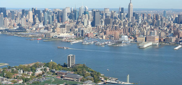
To park on campus:

Please stop first at the Howe Center. It is the tallest building on campus (building number 19 on the map) and can be easily seen on the first photo above. Please use the campus entrance from the 9th Street in order to get to the Howe Center. Drive along the 9th Street to climb the hill all the way up until the Howe Circle (dead end).

Ask for a parking hang tag from the Stevens police station located in the lobby of the Howe Center. The police will need your license plate number, model of the car, contact phone number and the reason you are visiting.


horizontal rule

Home Labs Location Publications